 Nederlands
 Dansk
Dansk østerreichisch
 Po Polsku
 Italiano
 Francaise
 Portugiesisch

Baumberge
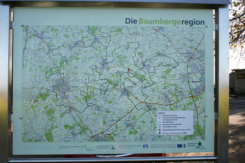
Inside the Münsterland, the Baumberge are situated between Billerbeck in the northwest, Havixbeck in the northeast, Senden-Bösensell in the southeast, Nottuln-Schapdetten, Nottuln-Appelhülsen in the south and Nottuln in the southwest. The A 43 runs past the Baumberge in the south and a bit easterly the A 1. The north part resp the edge of the mountain range, where the Baumbergschnecke operates, cuts resp touches as railway line, the Baumberg railway.
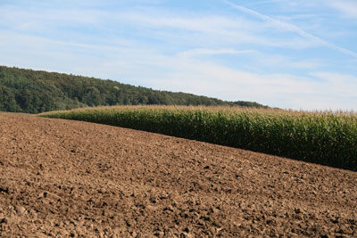
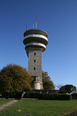
The Baumberge tower above the otherwise flat landscape up to 100m and reach in the Westerberg 187m above sea level. The peak is being crowned by the Longinus tower. Characteristic for this landscape is a relatively flat and treeless plateau with steep and from a certain height wooded edges. The plateau is, due to its water shortages, without a closed settlement.
The highest peaks in the Baumberge's surrounding area are the Schöppinger Hill near Schöppingen with 157,6m, Bentheimer Ridge near Bad Bentheim with 91,9m and the Gildehäuser Ridge with around 80m, which is located near Gildehaus in the west, the Altenberger Ridge with 113m and the Buchen Hill near Burgsteinfurt with 110m.
Baumberge's subsoil consist of lime sandstone, which is permeable to water. Thus the rainwater seeps away on the plateau into large depths. For centuries, the existing farms had to get their drinking water from 40m to 50m deep wells - but often, the supply happened via rainwater cisterns - before they were connected to a drinking water pipeline beginning of the 1970ties. The rainwater, which trickled away, come up again at Baumberge's edges in springs, whereby in just a few metres whole streams can come alight. Other characteristics of a karst mountain range like sink holes and dolines are also to be seen in the Baumberge.
Due to its close proximity to the sea, the Baumberge have a share of the drainage basins of some streams. The Hagenbach, as well as the south flowing river Stever, which arises here and is a tributary of the river Lippe, which in turn belongs to the Rhine. The east flowing Münster river Aa belongs to the stream system of the river Ems. The Vechte, rises near Darfeld at the foot of the Baumberge, flows in northwestern direction in the Netherlands and forms with the Dinkel its own small stream system. The west flowing Berkel has its river mouth in the Dutch IJssel.


